What I Did This Summer
It's been a few weeks since I last posted on The Wikipedian—at the time I had just finished covering Wikimania right here in Washington, DC, and I had made at least one promise to write a wrap-up post. Alas, that never happened: between work and travel and other obligations, I'm afraid "August 2012" will forever remain a blank spot in my archives. Well, it wouldn't be the first time. But there is a good reason, and one related—just a bit—to Wikipedia.
Over the last two years, and more intensively during the past two months, I have been working on a very large, personal project, and on Monday it was finally ready for release. It's called The Infinite Atlas Project. As I've described it elsewhere, the goal is to identify, place, and describe every cartographic point I could find in David Foster Wallace's iconic 1996 novel Infinite Jest—whether real, fictional, real but fictionalized, defunct or otherwise.
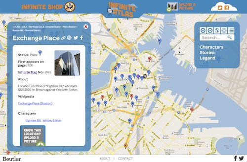
The project is tripartite, and the first part launched in mid-July: Infinite Boston, a photo tour hosted by Tumblr, which I'm writing daily through the end of this month. Launched just this week are two more ambitious efforts: a 24"x36" poster called Infinite Map, plotting 250 key locations from the novel's futuristic North America (and available for purchase, just FYI); and one not constrained by the dimensions of paper: Infinite Atlas, an interactive world map powered by Google Maps including all 600+ global locations that I was able to find with the help of my researchers (i.e. friends who had also read the novel). You can read much more about this on the Infinite Boston announcement post or on the Infinite Atlas "About" page, but here are screen shots of each:


Meanwhile, there are some aspects to the project that I think will be of interest to Wikipedians. For example, on the Infinite Atlas website, every entry that has a relevant Wikipedia article links back to it—whether to the exact location, such as the Cambridge Rindge and Latin School—or to the closest approximation, like the Neponset exit ramp, I-93 South. Among the development projects related to the online atlas, this was one of the last, but I think one of the most helpful. Yes, it's interesting to the reader to be reminded that a key character stays at McLean Hospital in Belmont, Massachusetts, but it's even more useful to confirm that McLean Hospital is a real place with more than 200 years of history. And both sites will tell you that DFW himself was a notable former patient.

Additionally, and importantly, the site is published under a Creative Commons license. For a research and art project based on a copyrighted fictional work—quoting judiciously and keeping fair use in mind, I stress—I figured it was important to disclaim any interest in preventing people from using it how they see fit—so long as they attribute and share-alike, of course. And another big reason for doing so: readers are invited to submit their own photos, so long as they are willing to approve their usage under the less-restrictive CC-BY license. If you live in one of the many locations around the world (though mostly in the U.S. and Canada) featured in the book, and now in the atlas, consider yourself invited to participate.

Live though these projects are, they are not finished and might not ever be. Which is part of the fun. And in that way like Wikipedia itself. Now maybe I'll finally get around to fixing up the Infinite Jest Wikipedia entry and taking it to FA...


